VIDEO: Rutometro — the Project Redefining Public Transport in Mexico
Missing bus routes? Not anymore. See how Trufi and partners use open transport data to fill Mexico’s mobility gaps.

Missing bus routes? Not anymore. See how Trufi and partners use open transport data to fill Mexico’s mobility gaps.

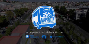
Open data and citizen-driven mapping are create digital transport maps that enable inclusive mobility in Mexican cities.
A VIP visit to Duitama highlighted the successes of our team, our app, and the work yet to be done for rural mobility.
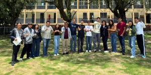
Grassroots mapping makes invisible transport systems visible. See Oaxaca volunteers collect route data to advocate for better public transit options.
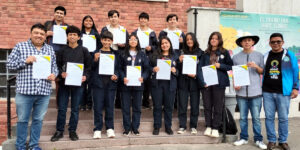
Help send Colombia’s Duitama Mapping Stars to State of the Map LATAM 2025. Support the students behind many of our transport data projects across the globe.

Transport justice can’t arrive with closed data. What the evolution of everyday tech reveals about the power of sharing information.
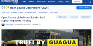
OSOR recognizes Trufi for advancing open-source public transport solutions, built on OpenStreetMap and global collaboration.
Collaborative mapping and open data are enhancing urban transport planning in Oaxaca, Toluca, and beyond – the TranSIT initiative in Mexico

A Moroccan developer illustrates how open-source projects can create career opportunities and make a lasting community impact.
GTFS data for Trujillo is now in MobilityDatabase, showcasing accuracy, sustainability, and impact for urban transport systems worldwide.