A community of OpenStreetMap (OSM) enthusiasts working with Trufi in Mauritania has completed mapping all of the public transport routes in the nation’s capital, Nouakchott. These include routes used by formal and informal transit, buses, minibus, and even taxis that run on established routes, much like buses.
- Kilometers Traveled*: 400
- Hours Traveled while tracing*: 55
- Bus and Taxi Routes Traced: 59
- GPS Traces: 61
* Approximate
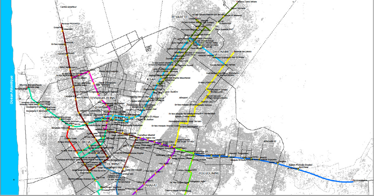
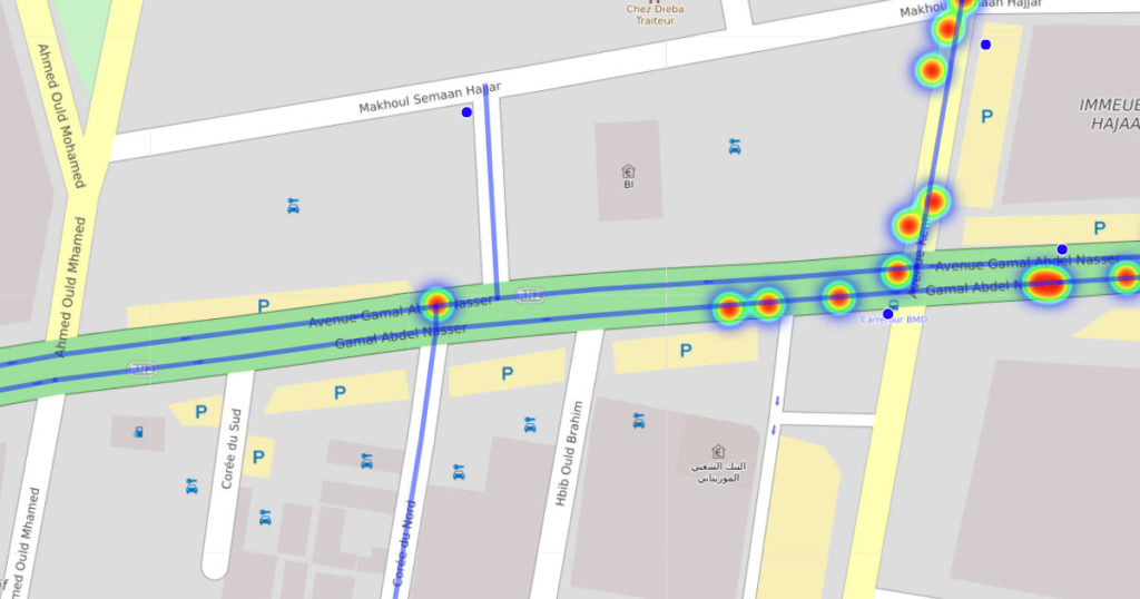
Public Transport Map of Nouakchott
Below is an interactive map showing the routes that the team has traced and mapped in Nouakchott. This is likely the first interactive public transport map of Mauritania’s capital.
Trufi is mapping public transport in Nouakchott with funding from the World Bank.
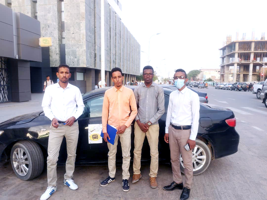
The Team in Nouakchott
To recruit a team in Nouakchott, Trufi tapped the OpenStreetMap Mauritania community. Six members mapped the public transit routes from March 23 to April 8. This same team will continue carrying out the next phase of the project.
The Dry Run: Mapping Mauritania from Bolivia (Using Bad Maps)
Before the Nouakchott team had been recruited and assembled, Trufi volunteers in Bolivia, Columbia, and Germany developed and refined the process of mapping, editing, and validating bus lines before committing the data to OpenStreetMap.
“There was a lot of chaos in Nouakchott,” said Zarah Ziadi, Trufi’s International Project Manager, based in Berlin, “but everything they have done has been very well structured.”
The international team created the shared resources (collaborative spreadsheets and documents), protocols, and custom code that would allow the team to work together. In order to shake down the process, the team found some low-resolution and outdated public transport maps to test the systems.
Working 6700 km from Nouakchott, Trufi volunteer Luz Choque mapped the first test routes from her home in Cochabamba, Bolivia. Choque compared the older public transport maps with to up-to-date street maps and satellite images, then traced the routes manually using an OpenStreetMap editor.
Choque was able to work quickly, having honed her mapping skills mapping more than 400 routes in Cochabamba. However, the routes she mapped for Nouakchott were ultimately replaced by accurate and updated routes traced by the local team.
Adaptation and Refining the Trufi M.O.
Once the Nouakchott team had been recruited, trained, and began tracking, they encountered some minor challenges and lessons learned. The team adapted to these issues with straightforward solutions, and at the same time they refined and contributed to Trufi’s M.O. for future work.
Tracking real-world bus routes meant (among other things) riding in buses for several hours per day with their smartphones on, GPS enabled, running the OSMTracker app, and providing receipts for expenses.
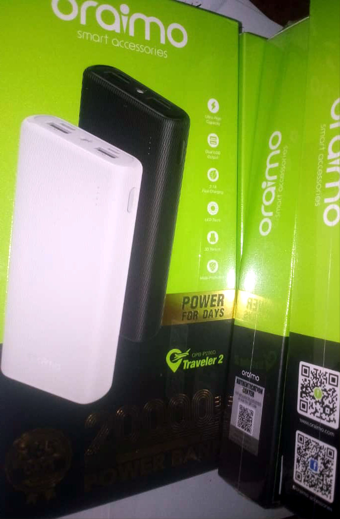
The team quickly learned that their smartphones did not have the battery life to work all day, even when they did not use data connections or other functions that consume batteries more quickly. Trufi procured portable power banks for everyone on the team so that they could trace routes without losing power.
The team had to manually capture some information about each bus route, then submit a form for each route at the end of the day. They found it more efficient to print out paper forms, and fill in the information in real time with the help of the bus driver. This had the added benefit of providing proof of payment so the team could be reimbursed for the bus fares.
Informal transit, such as minibuses (also known as paratransit) do not give out tickets or proof of payment. To satisfy the reimbursement requirements of the project – and to save time – the team rented a car and simply drove all of the minibus and taxi routes while tracing with the smartphone.


“It would take a very, very, long time to go line by line in taxis and minibuses.” said Jérémie Perales, CEO of Daba’Go, a mobility app company specializing in Africa, and Trufi’s regional manager for the Nouakchott project. “So they rented a car and drove the lines.”
At the end of each day, the mapping team convened at a café with Wi-Fi to upload and submit their data to OpenStreetMap, and to provide the route details to the Trufi team.
Turning Raw GPS Traces into Usable Public Transport Routes
After the new routing data had been added to OpenStreetMap, the Trufi team in Bolivia, Columbia, Morocco, Germany and other countries validated and cleaned the data, turning imprecise GPS scribbles into clean and clear routing information.
“We check to see if the traces are corresponding to the roads,” said Perales. “Normally GPS is precise to three meters, so we should be good with that. But we still check if the line crosses something it shouldn’t, the middle of a river or something like that.”
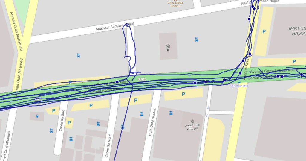
“We think about every stop, to ensure that the position of every stop is correct on the map. After that, we can say that the line is good,” said Perales. “With satellite images we can see the real roads, so if there something missing, we just follow the roads on the satellite image.”
The Next Phase: Photographs and AI for Mapillary
The Nouakchott team will again rent a car drive the principal corridors of the city, this time with a camera mounted to the car. They will capture photographs to be added to Mapillary, a community orientated alternative to Google Street View.
Mapillary uses Artificial Intelligence to analyze community-submitted photos – often taken by dashcams – to detect and plot objects such as lane markings, mailboxes, trash cans, traffic lights, and manholes. In a future post, there will be more on the Mapillary phase of Trufi’s work in Nouakchott.
Pingback: weeklyOSM 560 | weekly – semanario – hebdo – 週刊 – týdeník – Wochennotiz – 주간 – tygodnik
This is truly magic made possible by OSM. Amazing! Thank you for sharing you story and the process behind the project.
Bravo,je suis une bonne continuation.
Je suis ingénieur SIG et Télédétection au ministère du développement Rural en Mauritanie et je souhaiterais participer à vos activités avenir.