As always, I wanted to take the public transport to the hotel because it is the best and most sustainable way to travel through cities – if you cannot make it by foot or bicycle. Also, you get to know many people and get a good feeling about people and the city. Plus you get first-hand experiences on the bus system.
I tried to find the route to the hotel and used Google Maps, which works great in the “global North.”
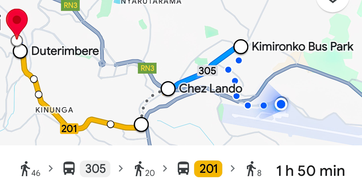
Screenshot: Google Maps’ public transport directions in Kigali, Rwanda. Not up to date.
The results were not promising because at least two bus lines were obviously missing – including the first one I needed. Other travelers convinced me to join their taxi because otherwise it would have been really difficult.
Some days later I used public transport and I know that the travel would have been indeed long (Kigali is a spread out city). The bus routes have been recently changing a lot making the Google Maps data is partly outdated.
It was another moment when I looked forward to a day when using a local mobility app will inform me about my best travel options, and help me to book a ticket. And of course all this future app will feature real-time bus data.
And Google Maps Can Use the Data
Fun fact: People in the Mobility Lab team are currently collecting all bus lines, mapping them on OpenStreetMap. Our partner Enrouteq creates a GTFS out of it that will be used in the Kigali Smart Mobility Lab. But we will also share the routes with Google Maps, because we always want to maximize the benefit for all users.