The End of Trufi – As an All-Volunteer NGO
Trufi Association has hired a staff of five professionals, graduating out of our two-year run as an all-volunteer NGO.

Trufi Association has hired a staff of five professionals, graduating out of our two-year run as an all-volunteer NGO.
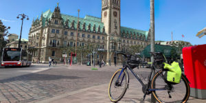
Trufi’s bike app will connect cycling to public transport like no other. Launching October 2021 at the ITS World Congress in Hamburg
Trufi’s presentation to this year’s conference of the OpenStreetMap community, State of the Map 2021.
Two perspectives: A local mapper and an international expert in urban transport discuss the impact of public transport data in Mauritania’s capital.
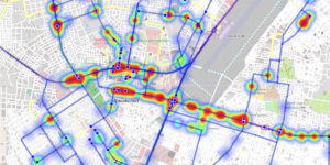
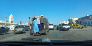
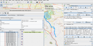
A new complete and interactive map of public transport routes in Mauritania’s capital – a first for the African country.

Trufi will create the first thorough public transport map of Nouakchott, Mauritania. There is currently no map, no app, no website.
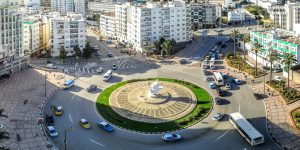
A young Moroccan developer has created a new app called Corsa Tétouan, and he single-handedly mapped the city’s entire public transport network.

Our public transport app for cyclists, Not Without My Bike is the only app that helps cyclists create itineraries that combine cycling and public transport. This is our presentation to the International Transportation Summit.

A new fork of the Trufi App will let bike riders blend cycling journeys with public transport. Trufi Association volunteers developed the new version during the fourth ITS MOIN Hackathon, …
Do you wonder how to map informal bus routes with OpenStreetMap? Our teammate Sören Reinecke answers this question in his documentation on GitHub. This is a good start for all …